

Meteorologist Tony Nargi's First Warning Forecast
Temperatures will drop into the 60s this evening with clear skies expected. It should be a great evening for a run or walk. Overnight some passing clouds will go by with some patchy fog possible towards dawn. Lows will only drop into the 50s and low 60s.

Wednesday will be another day of record warmth, with highs reaching the low to mid 80s. It will be mostly sunny to be partly cloudy, with a stray shower possible during the afternoon. We'll see winds pick up during the afternoon out of the SW at 10-20 mph, with gusts up to 30 mph. Overnight clouds will build, with thunderstorms possible on the Eastern Shore, particularly in Accomack county after midnight. An isolated severe thunderstorm could be possible after midnight for the Eastern Shore, with the main threat being damaging wind gusts, though a non-zero chance for tornadoes and large hail exists as well. Temperatures will stay mild in the 70s and upper 60s. We'll see rain and thunderstorms starting to move into the rest of the region towards sunrise.

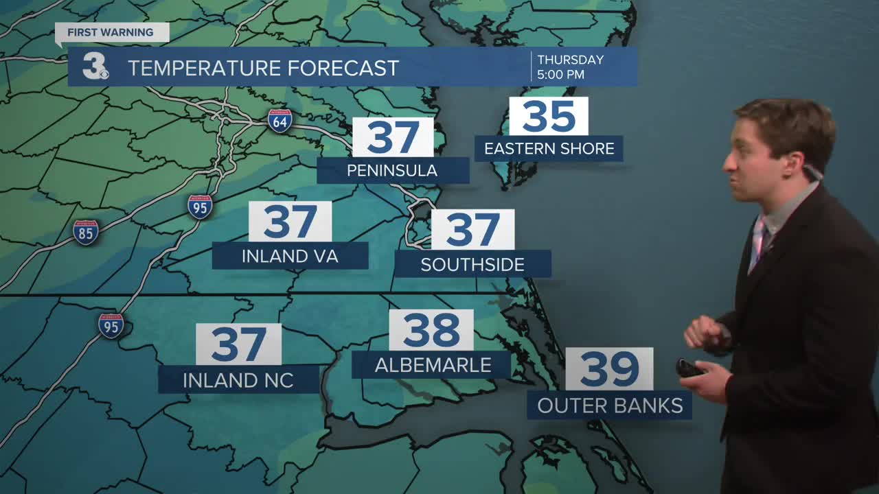
Thursday will start off with rain and thunderstorms, with morning high temperatures in the 70s. Temperatures drop throughout the day, with temps dropping into the 40s and upper 30s by the afternoon. Rain throughout the morning and early afternoon may change over to a wintry mix and sleet later on in the afternoon as temperatures rapidly cool. Rain and sleet will end by sunset around 7 pm. Winds will turn out of the N at 15-25 mph, with gusts up to 40 mph. Temperatures will fall into the low to mid 30s overnight Thursday.

Sunshine returns Friday and Saturday with near normal high temperatures around 60. Warmer weather returns on Sunday, along with the chance of rain and storms.

Weather updates on social media:
