


Meteorologist Tony Nargi's First Warning Forecast
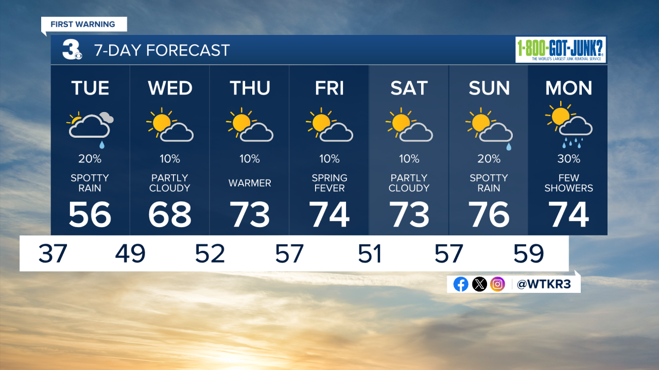
This evening temperatures will drop into the upper 30s with scattered rain showers continuing through midnight. Temperatures will slowly rise into the low 40s after midnight. Winds will drop off to 5-10 mph out of the NE.


Tomorrow will start off cloudy with a couple of stray showers possible in the early morning, with dry conditions by midday. During the afternoon some partial clearing is expected. High temperatures will reach the mid 50s to low 60s, with mid 60s possible for inland North Carolina. Overnight more clearing is expected with overnight lows only dropping into the 40s.

Wednesday will be the start of a significant warming trend for Hampton Roads. We'll see a mix of sun and clouds along with much warmer temperatures in the upper 60s to around 70. Winds will be light out of the W at 5-10. Overnight lows will only drop into the 50s. Thursday will be even warmer, with high temperatures jumping into the low to mid 70s. We'll see winds out of the SW at 5-15 mph.

This weekend the warm weather will stick around! High temperatures are slated to stay in the 70s through Monday, with only a few shower chances possible to begin next week. Warm weather is likely to last through much of next week as well!
Weather updates on social media:
