

Meteorologist Tony Nargi's First Warning Forecast
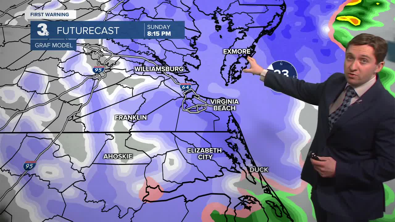
Today will start out with rain and temperatures in the 40s. Rain will change over to snow during the from north to south during the afternoon as temperatures drop into the 30s. A blizzard warning goes into effect this afternoon along the Eastern Shore.

Heavy snow is expected at times along the Eastern Shore, with lighter snow south and west. Snow will last throughout the evening, tapering off before midnight for most. Snow will linger along the Eastern Shore through the night and into Monday morning. Snow totals will be minor for most (T-2"), with 4-8" of snow expected in Accomack County where snow lasts longer. It will be windy, with winds out of the NW at 20-30 mph this evening, with gusts up to 45 mph along the coast. Some nuisance tidal flooding is possible Sunday during the afternoon tide cycle and early Monday morning tide cycle.


Tomorrow will be mostly cloudy with light snow possible along the Eastern Shore during the morning. A stray shower or flurry is possible elsewhere, with high temperatures reaching the low to mid 40s by the afternoon. It will be breezy, with winds out of the WNW at 15-25 mph. Overnight Monday winds should drop off and clouds should clear out. Lows will drop into the 20s. Tuesday will be another cool day, with highs in the low 40s along with mostly sunny skies.
Temperatures rebound on Wednesday into the upper 50s, with a 20% chance of a stray shower. Widespread rain returns on Thursday afternoon as temperatures jump into the 60s.

Weather updates on social media:
