

Meteorologist Tony Nargi's First Warning Forecast
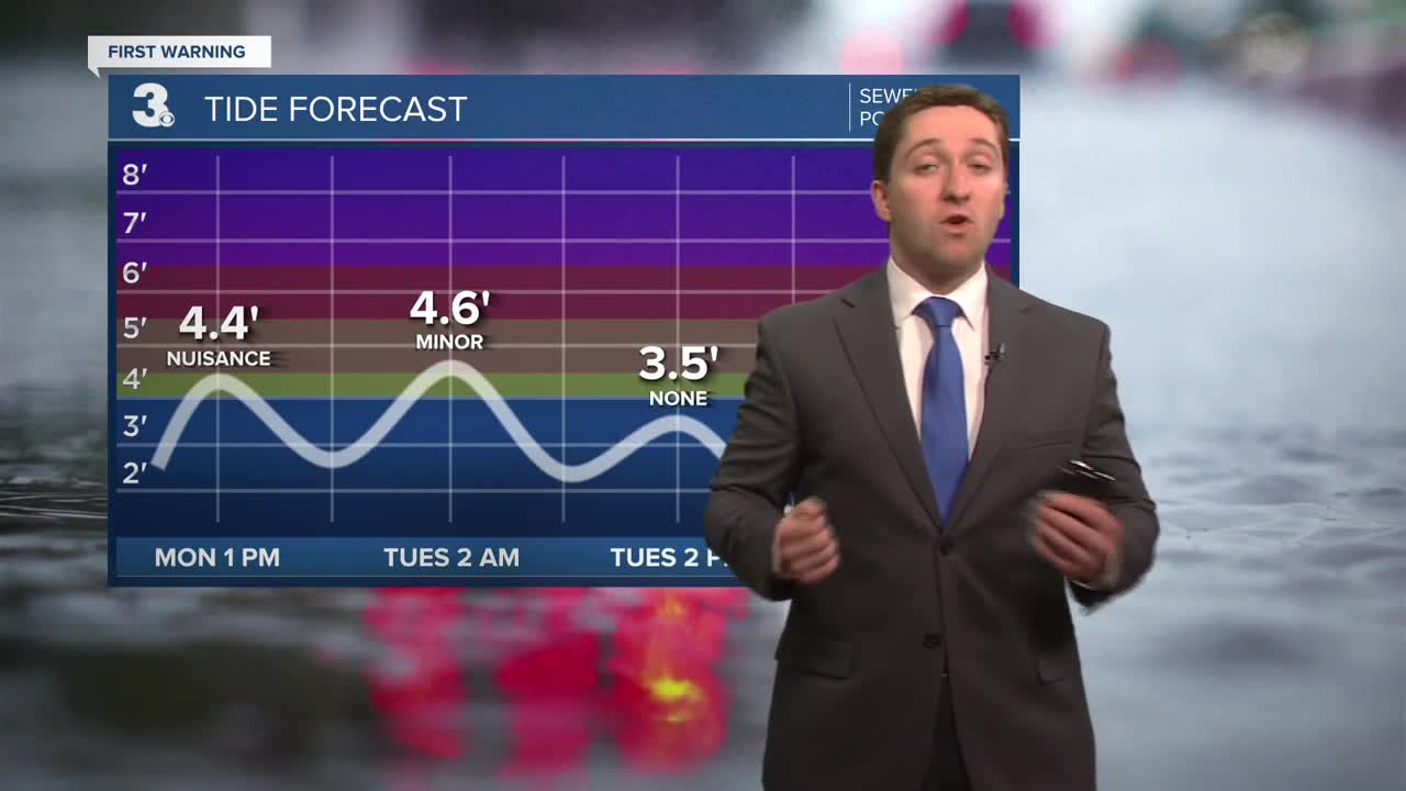
Today will start out cool and windy with temperatures in the low 30s along with winds out of the NW at 20-25 mph with gusts up to 40 mph on the Eastern Shore. Road conditions will still be slippery on the Eastern Shore through the morning after nearly 10" of snow fell in parts of Accomack County. We'll see mostly cloudy skies along with high temperatures reaching the low to mid 40s this afternoon. Overnight skies will clear out as temperatures drop into the 20s. Some tidal flooding is possible today, with nuisance to minor flooding expected during the Monday afternoon high tide around 1 PM to 2 PM.


Tuesday will be less windy and mostly sunny. Some ice is possible from refreeze during the early morning. By the afternoon temperatures will reach the low to mid 40s with mostly sunny skies and lighter winds out of the W at 5-15 mph. Overnight Tuesday temperatures will drop into the low to mid 30s. Wednesday will be warmer, with clouds in the morning followed by sunshine during the afternoon. High temperatures will reach the mid 50s to near 60. Winds will be out of the SW at 10-20 mph.


Rain returns to the region on Thursday as a warm front passes through. We'll see rain Thursday afternoon into Thursday night, with some showers lingering into Friday morning. This weekend looks mainly dry, with just a stray shower possible on Sunday.

Weather updates on social media:
