
Meteorologist Tony Nargi's First Warning Forecast
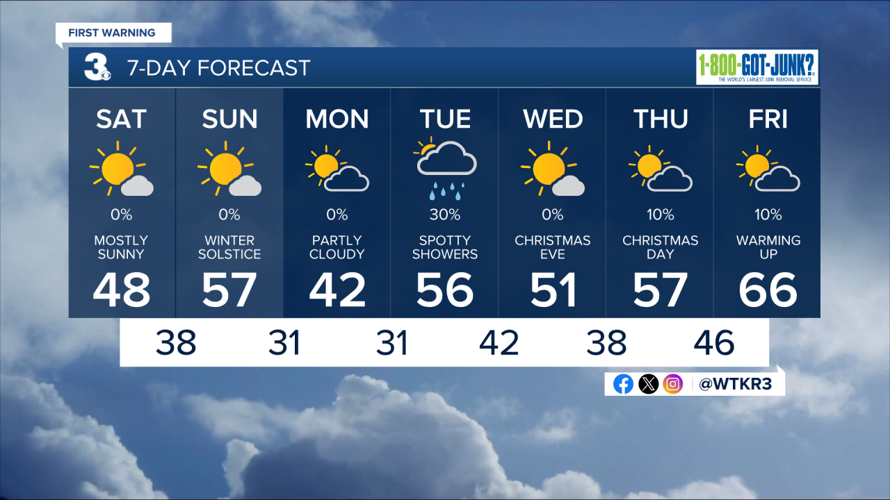
Today will start off cool in the 30s, with below normal high temperatures this afternoon in the 40s. We'll see mostly sunny skies along with light winds out of the NE at 5-10 mph, turning out of the S during the afternoon/evening. We'll see mostly clear skies continue overnight, with lows temperatures dropping into the mid to upper 30s. Winds overnight will pick up out of the SW at 10-15 mph.

Tomorrow will be mostly sunny and warmer, with high temperatures reaching the mid to upper 50s. Winds will be out of the SW at 10-15 mph, turning out of the WNW at 10-15 mph during the afternoon. The winter solstice occurs at 10:03 am on Sunday! A cold front will move through during the late afternoon, with an isolated showers possible along with quickly dropping temperatures expected overnight. Monday will be cool, with high temperatures in the low 40s. Winds will be light out of the N at 5-10 mph. Sunny skies in the morning will turn to partly cloudy skies during the afternoon.

A chance of rain will move in on Tuesday as a clipper system slides to our north. Temperatures will stay near normal for Christmas Eve and Christmas, in the 50s with dry conditions expected. Much warmer weather moves in after Christmas.

Weather updates on social media:
