

Meteorologist Tony Nargi's First Warning Forecast
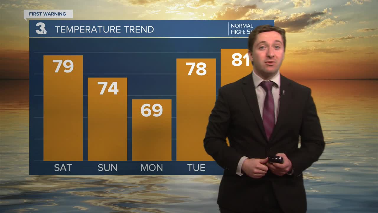
Today will start off with widespread fog, with the potential for some dense fog and visibility less than a quarter mile. Take caution while driving this morning, a dense fog advisory is in effect until 10 am. After 10 am we'll start to warm up, with mostly sunny skies expected by the afternoon and high temperatures in the upper 70s to low 80s. It will be a bit cooler on the Eastern Shore, in the 60s. Winds will be out of the SW at 10-15 mph. This evening we'll see mostly clear skies , with clouds developing after midnight. Overnight lows will drop into the 50s and low 60s.

Sunday will be mostly cloudy and warm with high temperatures reaching the mid to upper 70s. Winds will be out of the SW at 10-20 mph. Some peaks of sunshine are possible during the morning and early afternoon. Showers and thunderstorms will begin to develop during the afternoon, arriving between 3 PM and 7 PM. An isolated severe storm capable of producing damaging wind gusts and large hail is possible Sunday PM, though widespread severe storms are not expected.


Overnight showers will taper off with lows dropping to around 50. Monday will start off with clouds and spotty drizzle, followed by sunshine emerging during the afternoon. Highs will be in the upper 60 to low 70s. Winds will be out of the S at 5-10 mph.

Tuesday and Wednesday will continue the warm streak in Hampton Roads, with high temperatures reaching the upper 70s to low 80s. We'll stay mainly dry Tuesday and Wednesday, with rain returning Thursday morning. Temperatures will drop back to normal as we close out next week.

Weather updates on social media:
