

Meteorologist Tony Nargi's First Warning Forecast
This evening temps will drop into the mid 30s but hover above the freezing mark throughout the night. A few rain/snow showers are possible along/north of I-64, with little to no accumulation expected. Winds will be light out of the S at 4-8 mph.

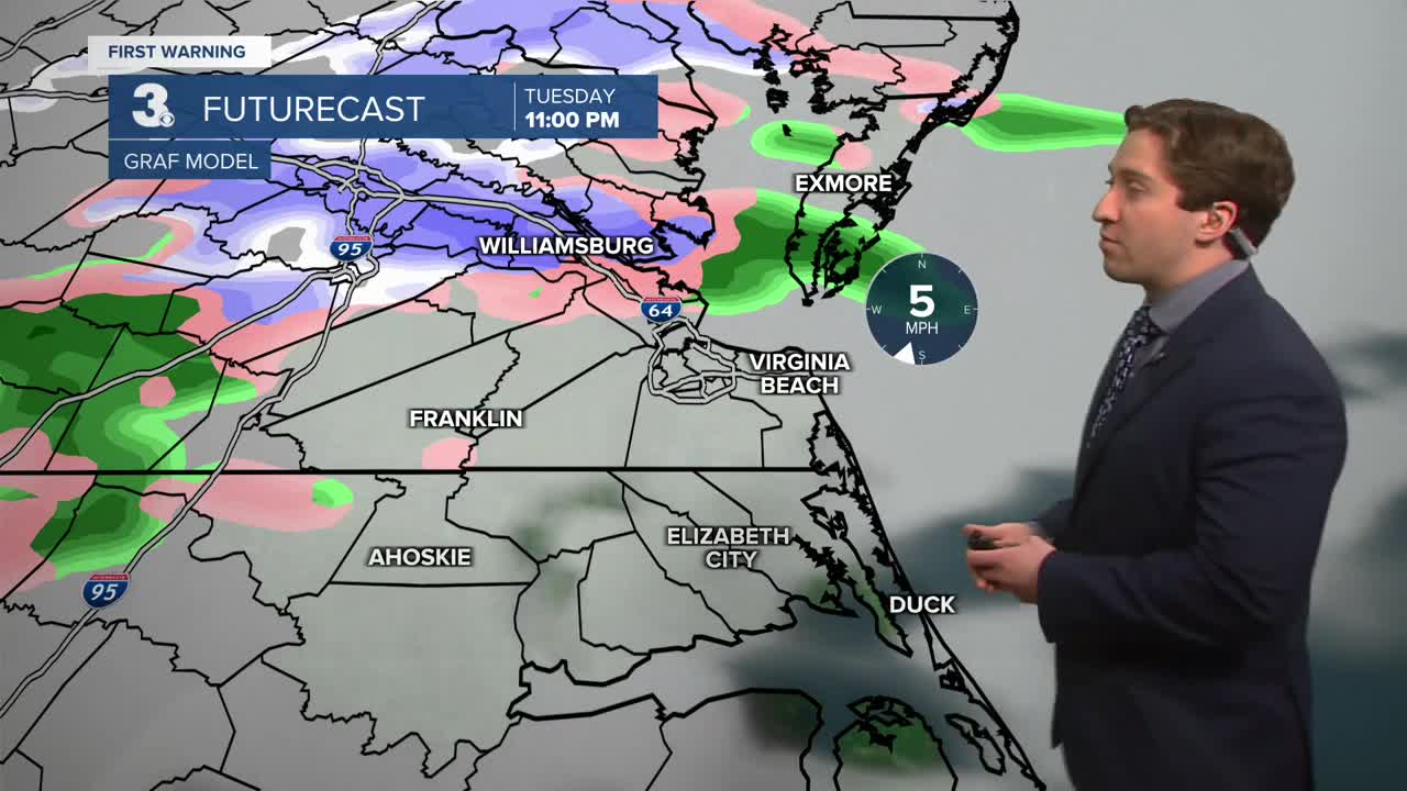
Tomorrow will be mainly dry during the morning along with mostly cloudy skies. Temps will start in the low to mid 30s and reach the mid 30s to low 40s by lunchtime. Temps will then drop during the afternoon and evening back down to the low to mid 30s as colder air slowly moves in. Showers will develop along the Albemarle and Outer Banks during the afternoon, with a mix of rain/snow expected to develop in Hampton Roads late in the afternoon. Winds will be out of the NE at 10-15 mph.

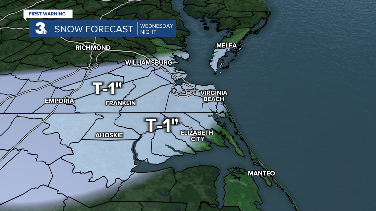
Overnight temperatures will drop into the upper 20s to around 30 as rain/snow mix turns to light snow. A glaze of freezing rain is also possible inland as temps cool off overnight. Accumulations will be minimal, with a trace to an inch of snow expected. A few isolated amounts of 1-2" of snow are possible away from the coastline. Snow ends before sunrise on Thursday.

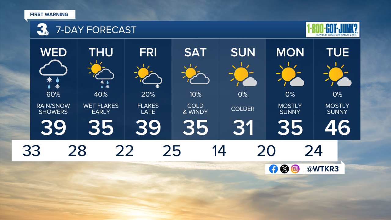
Thursday will be a cool and breezy with highs in the low to mid 30s along with winds out of the N at 10-20 mph. We'll see clouds in the morning along with some leftover rain/snow showers possible on the Outer Banks. Skies will clear by the afternoon. Friday will be mostly sunny to start along with highs in the mid 30s to low 40s. Clouds will arrive late Friday, with some flurries possible Friday night. This weekend will be cold once again, with low temperatures dropping into the teens by Sunday morning!
Weather updates on social media:
