

Meteorologist Tony Nargi's First Warning Forecast
This evening clouds will build as a warm front begins to slide closer to our area. Temperatures will drop into the mid to upper 30s later this evening, before starting to warm back up to the upper 30s to near 40 by sunrise. Winds will be out of the S at 5-10 mph. A few showers are possible towards dawn.

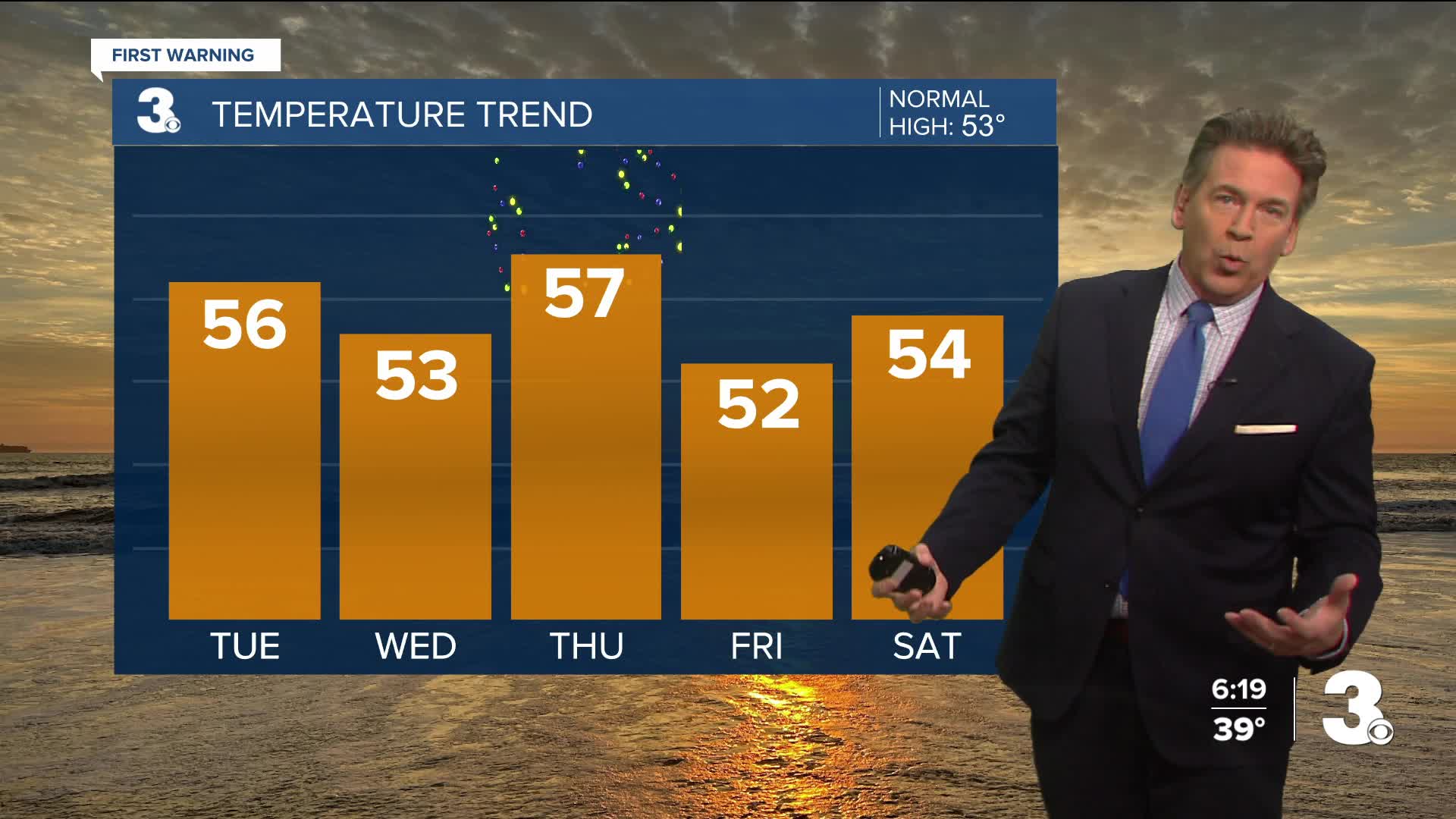
Tomorrow morning will start with cloudy skies and scattered showers. We'll be a step warmer with temperatures in the mid to upper 50s. Winds will be out of the SW at 10-15 mph. Showers will clear out during the afternoon, with some sunshine returning before sunset. Overnight temperatures will only drop into the upper 30s to mid 40s. We'll see clear skies overnight, with mostly sunny skies expected on Christmas Eve. High temperatures will be near normal in the low to mid 50s. Winds will be out of the N at 10-15 mph. Christmas Eve night looks great for Santa, with partly cloudy skies and temperatures in the 40s.


Christmas morning will start with some cloudy skies and a 20% chance of a stray shower. High temperatures will be mild, with mid 50s to near 60 for high temperatures. Temps will stay in the 50s to end out the week, with a jump into the 60s possible by Sunday.

Weather updates on social media:
