

Meteorologist Tony Nargi's First Warning Forecast
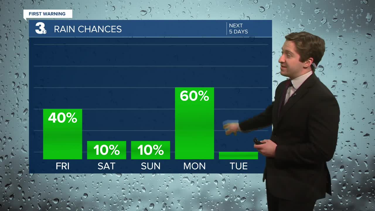
Today will start off with some sunshine followed by increasing clouds during the morning. Temperatures will start off in the 30s and low 40s, with high temperatures reaching the mid to upper 40s during the afternoon. Winds will be out of the ENE at 5-10 mph, turning out of the S overnight. Some scattered showers are possible evening between 9 pm and 2 am, particularly along the Eastern Shore. Temperatures stay in the 40s overnight, with clearing expected late.

Tomorrow will be mostly sunny and seasonable, with high temperatures reaching the upper 40s to lower 50s. It will be breezy, with winds out of the N at 10-20 mph. This weekend will be mainly dry, however some clouds will move in on Sunday. Temperatures will drop into the 30s Saturday night, with another seasonable day expected Sunday as temperatures reach the low 50s by the afternoon. Winds will be lighter on Sunday, out of the N at 5-15 mph.


Another round of showers will move through on Monday. Temperatures will jump into the upper 60s to near 70, before cooling back down to the 40s on Tuesday.

Weather updates on social media:
