

Meteorologist Tony Nargi's First Warning Forecast
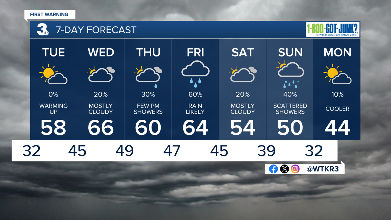
This evening clouds will finally move off and make way for clear skies. Clear skies along with calm winds and temperatures dropping into the low 30s will lead to some patchy dense fog late tonight.

Tomorrow morning will start off with a lingering fog lasting through 9 or 10 am, followed by partly cloudy to mostly sunny skies. We'll see high temperatures in the upper 50s to low 60s, with winds out of the SW at 5-10 mph. Clouds will move in late Tuesday night, with overnight lows dropping into the 40s.

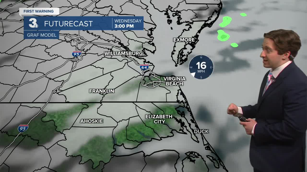
Wednesday will be a mild one with high temperatures jumping into the mid to upper 60s. It will be breezy, with winds out of the SW at 10-20 mph. We'll see mostly cloudy skies throughout the day, along with a slight (20%) chance of a stray shower during the afternoon. On Thursday, clouds will remain in place, with some scattered showers developing during the afternoon. Highs on Thursday will reach the low 60s.

Widespread rain moves back into the picture on Friday, as a strengthening storm passes to our north. Showers may linger into Saturday, and another system may bring some rain to the area on Sunday.
Weather updates on social media:
