

Meteorologist Tony Nargi's First Warning Forecast
This evening temperatures will fall into the 40s with lighter winds out of the SW at 5-10 mph. We'll see clear skies for most of the night, with overnight lows reaching the upper 30s to low 40s by sunrise.

Tomorrow morning clouds will start to build, with mostly sunny skies in the morning turning to mostly cloudy skies during the afternoon. High temperatures will reach the upper 50s to around 60. Winds will pick up out of the SW at 10-15 mph, gusting over 20 mph at times. There is a 20% chance of some showers, though most of us stay dry. The Outer Banks will have the best chance of seeing any rain.

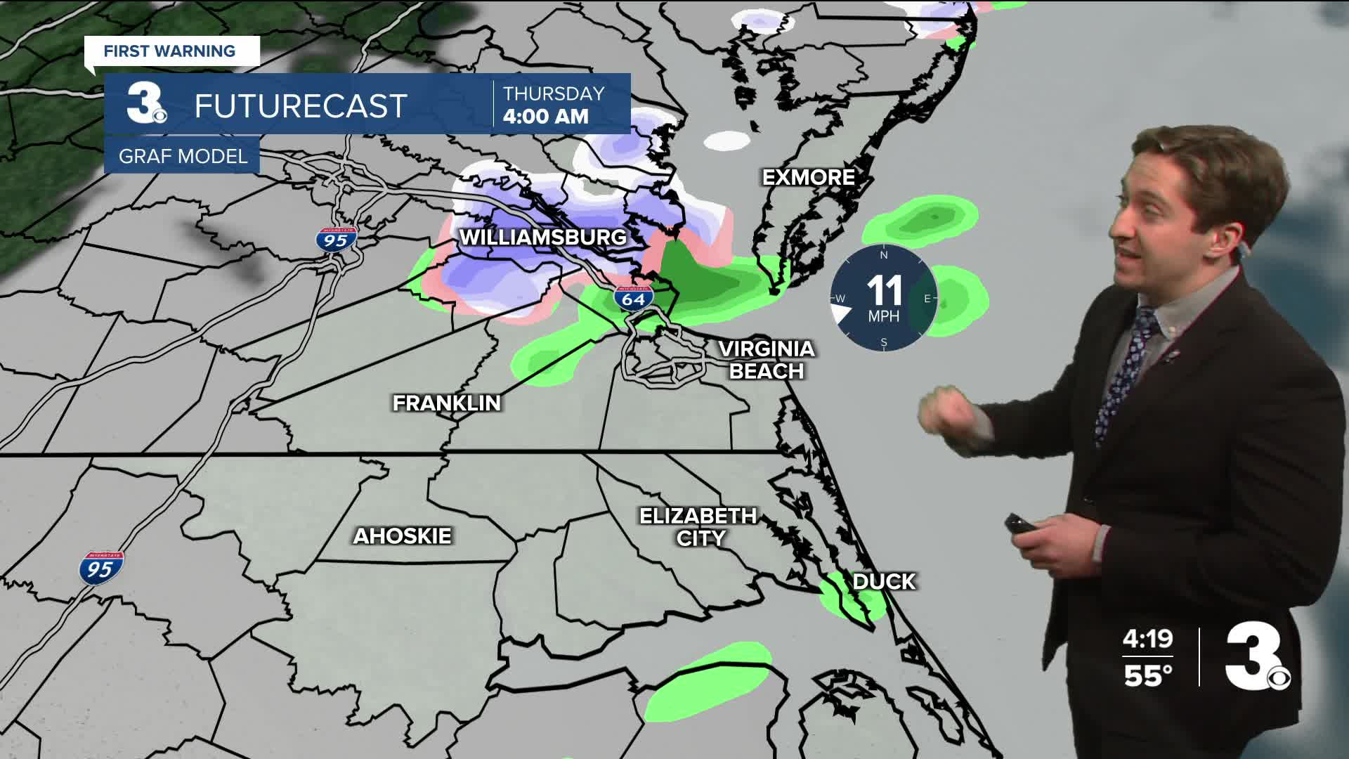
Overnight Wednesday, a cold front will start to move towards Hampton Roads, with a line of rain showers changing over to snow showers as temperatures drop. Little to no snow accumulation is expected, but some flakes before daybreak are possible. Temperatures in the 40s early Thursday morning will plummet into the low 30s by sunrise. Temps will then stay in the 30s for the rest of the day. Overnight will be chilly, with temperatures reaching the 20s and teens for inland areas. Friday will be mostly sunny and cool with highs in the 40s.

This weekend our weather will be fairly uneventful, with just a couple of stray showers possible both Saturday and Sunday, with a 20% chance of rain both days. Even colder weather is expected after the long weekend.

Weather updates on social media:
