

Meteorologist Tony Nargi's First Warning Forecast
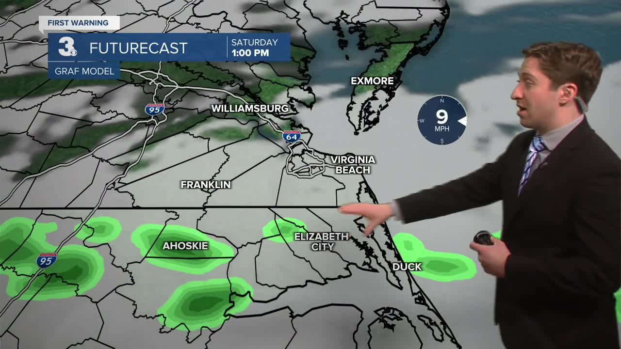
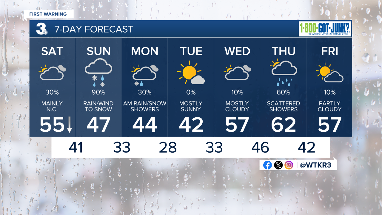
Today will be mostly cloudy to start with some showers possible along and south of the Albemarle in North Carolina. Temperatures will reach the low to mid 50s by around lunchtime before temperatures start to drop during the afternoon. Some sunshine will emerge this afternoon. Winds will be light out of the E at 5-10 mph. Overnight clouds will return with some showers likely late. Lows will reach the low to mid 40s.

Tomorrow a strong Nor'easter will start to develop offshore and rapidly strengthen throughout the day. We'll see showers in the morning, with steady rain and windy conditions during the early afternoon. Rain will flip to wet snow from north to south during the afternoon on Sunday. Wet snow will last throughout the evening on Sunday, tapering off late Sunday night. Some minor snowfall accumulation is possible, with most areas seeing less than an inch of snow. The Eastern Shore, especially towards the Maryland border, will have the best chance of seeing more than an inch of wet snow. Temperatures on Sunday will be in the 40s, dropping into the low to mid 30s during the afternoon as rain changes over to snow. It will be windy, with winds picking up out of the NW during the afternoon at 20-30 mph, gusting up to 40 mph at times.


On Monday, a few rain/snow showers are possible during the morning, with windy and mostly cloudy conditions expected. High temperatures will reach the mid 40s, with winds out of the WNW at 15-25 mph. We'll see sunshine and cool conditions Tuesday, before warmer weather returns Wednesday into Thursday.
Weather updates on social media:
