


NORFOLK, Va. — Norfolk’s multi-billion dollar flood wall project is taking another step forward.
The City Planning Commission unanimously approved the Phase 1A design of the Resilient Norfolk Coastal Storm Risk Management (CSRM) Project during its June 26 meeting, clearing the way for major construction to begin this fall. City leaders say residents will notice changes soon.
City officials say work to relocate private utilities is already underway, and once that work is finished, residents will soon see visible changes along the Elizabeth River waterfront.
“This is one of the biggest resilience projects in Norfolk’s history,” said Matt Simons, deputy director in the City Manager’s Office of Resilience. “The most visible parts of Phase 1A are those... between the Berkley Bridge and Harbor Park, the baseball stadium, and so that shoreline along Water Street is going to be dramatically altered.”
Previous coverage: Norfolk Planning Commission approves first phase of flood wall construction
Phase 1A carries an estimated price tag of about $250 million, Simons said. It will stretch from the Berkley Bridge eastward behind Harbor Park and toward the Norfolk Southern and Amtrak rail lines. The first phase ties into the city’s Ohio Creek Watershed Project and will ultimately connect to the Campostella Bridge.
The work includes relocating Dominion Energy and Verizon lines, replacing an aging water line, and clearing underground obstructions left behind by older buildings.
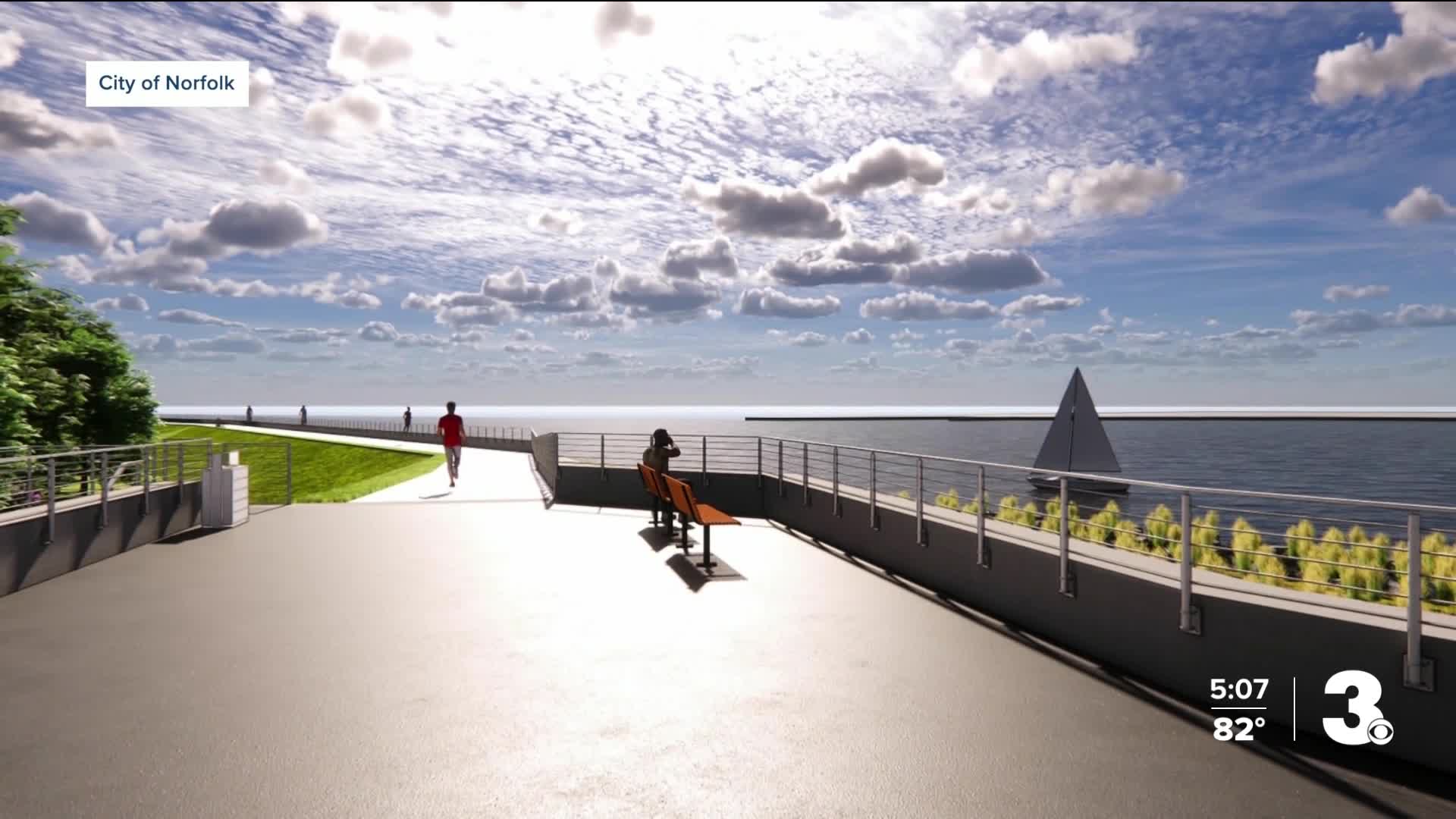
According to city plans, features in Phase 1A include community gathering spaces with elevated waterfront views, improved lighting, connections to the Elizabeth River Trail, and areas for public art. The flood wall will range in height from 16.5 feet behind the Dominion substation—protecting a key piece of infrastructure—to about 6.5 feet at Claiborne Avenue. Living shorelines and an earthen berm will enhance the waterline in this former industrial section of downtown.
“A lot of folks will just initially see the bulldozers and the heavy construction and the movement of dirt out there,” Simons said. “But then as people start to pay attention to the messaging and the renderings and the visuals that we’re sharing... then I think that folks will start to [get a] good picture of what this is all going to look like once the dirt is done and settled.”
The city will also build a new pump station at Harbor Park to ensure stormwater is directed away from downtown and toward the river.
Simons stressed that public feedback is central to the project’s success.
“We couldn’t design this without their input,” he told Norfolk Neighborhood Reporter Jay Greene. “We have to understand, what’s the community expecting? What do they need to be a part of... in order for it to really provide an asset and a benefit to their community?”
To help gather feedback, the Office of Resilience is holding public office hours from 3 p.m. to 6 p.m. Tuesday at Norfolk City Hall. Residents can review renderings, pick up handouts, and talk directly with staff about project details.
“Well, we’re going to have renderings. We’re going to have things that they can take with them, take away, take it back to their families and their communities to understand, what these features look like? What’s the timeline?” Simons said.
Another high-profile portion of the project will impact the Freemason neighborhood. Earlier this year, News 3 reported concerns from some residents about how a flood wall could affect the historic character of the community.
Simons said the Army Corps recently tasked Jacobs Engineering with advancing designs for the Freemason section to the 30% level. As those early sketches come together, he said, the city and Army Corps will bring them to residents for review and feedback as part of a partnership process.
While Phase 1A is expected to break ground this fall, the full CSRM project will span multiple phases across the city.
“I think that the public is going to understand that these features are built into the shoreline,” Simons said. “When we say things like, we are a community that is living with the water, that’s going to start to resonate as users are accessing the water’s edge... That we’re taking steps to live with the water and to understand its impact and prepare for its risk, but also bring users and residents to the water’s edge as well.”
