

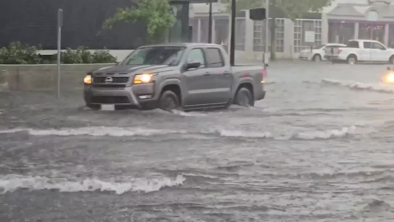


NORFOLK, Va. — Tuesday's storms turned some of Norfolk's most flood-prone streets into rivers, stranding vehicles and leaving drivers navigating several feet of standing water in some locations.
According to the City of Norfolk, the flooding was concentrated primarily in the western portion of the city, where rainfall totals varied dramatically. While Norfolk International Airport recorded 1.22 inches of rain, gauges in Ghent measured as much as 6.11 inches.
City officials said the flooding resulted from slow-moving thunderstorms that developed along a warm front moving through the region, combined with an unusually moisture-rich atmosphere capable of producing torrential rainfall. The heaviest rain fell between 1 p.m. and 3:30 p.m., with a weather station at Old Dominion University measuring 1.6 inches of rain in just 30 minutes between 2:30 p.m. and 3 p.m.
Compounding the problem, high tide arrived during the heaviest rainfall and was about a half-foot above normal, limiting how quickly stormwater could drain into surrounding waterways.
Dr. Jessica Whitehead, executive director of Old Dominion University's Institute for Coastal Adaptation and Resilience, said those factors created the perfect conditions for widespread street flooding.
"It certainly is not the record event, but is it a significant event? Yes," Whitehead said. "I would hesitate to say historic just because it's not the worst of the worst."
Rain fell faster than the system could handle
Whitehead said Norfolk's stormwater infrastructure is designed to handle a certain amount of rainfall, but Tuesday's storm exceeded those limits.
"What happened yesterday is we got an amount of rainfall that, depending on exactly where you are, was somewhere between a one-in-50 and a one-in-100-year return period," she said. "The stormwater systems just aren't built to take that much water at the same time."
The city said that when rainfall measurements from several gauges in the Ghent and downtown areas are averaged together, Tuesday's storm could be classified as a 200-year rainfall event, meaning it has roughly a 0.5% chance of occurring in any given year.
Whitehead said timing also played a major role.
"When the river levels are higher, there's less space in the stormwater system for that water to get out," she said. "What does it do? It backs up and it stays in the street."
Public Works crews responded throughout the storm
City officials said Public Works crews were already monitoring conditions and responded throughout the afternoon to clear clogged drains and ensure pump stations remained operational.
According to the city, all pump stations continued operating during the storm. Two of Norfolk's three flood-prone underpasses had reopened by 7 p.m., and the third reopened before 9 p.m.
Officials also pointed to several flood-mitigation projects already in place, including the Ohio Creek Project and the St. Paul's Blue/Greenway project, saying those investments are part of a long-term strategy to slow runoff, temporarily store stormwater and improve drainage across the city.
A reminder to prepare now
Whitehead said Tuesday's flooding should serve as a reminder for both longtime residents and newcomers to Hampton Roads.
"This is the biggest event that I've seen since I got here in terms of that amount of rainfall in that short a period of time," she said. "If you are also new to the Hampton Roads area, it's really important to know that this can happen here. It does not happen often, but when it does, it can be very disruptive."
She encouraged residents to think about how they would respond if an even larger storm struck.
"If yesterday was problematic for you, it should be a wake-up call as to what would you do if this happened more often, or what would you do if you had to deal with a bigger storm?"
Whitehead also urged residents to avoid becoming complacent after flooding events.
"Just because your part of the city didn't get it yesterday, doesn't mean your part of the city will never get it the next time," she said. "This kind of thing can happen anywhere, and avoiding that complacency, understanding, and having that situational awareness is really important."
She also recommended purchasing flood insurance and staying out of flooded roadways.
"Get flood insurance. Do it today," Whitehead said. "If you saw water outside yesterday, you could flood. Just because you didn't flood this time doesn't mean it won't be you the next time."
The city also encourages drivers to use the free Waze app, which integrates Norfolk's flood prediction system. Officials said the city uses continuously running hydrodynamic models that combine rainfall rates and tide data to predict flooded roads and send real-time alerts through the app, helping drivers navigate around flooded areas.
Click here to see how we use AI at WTKR News 3.
