

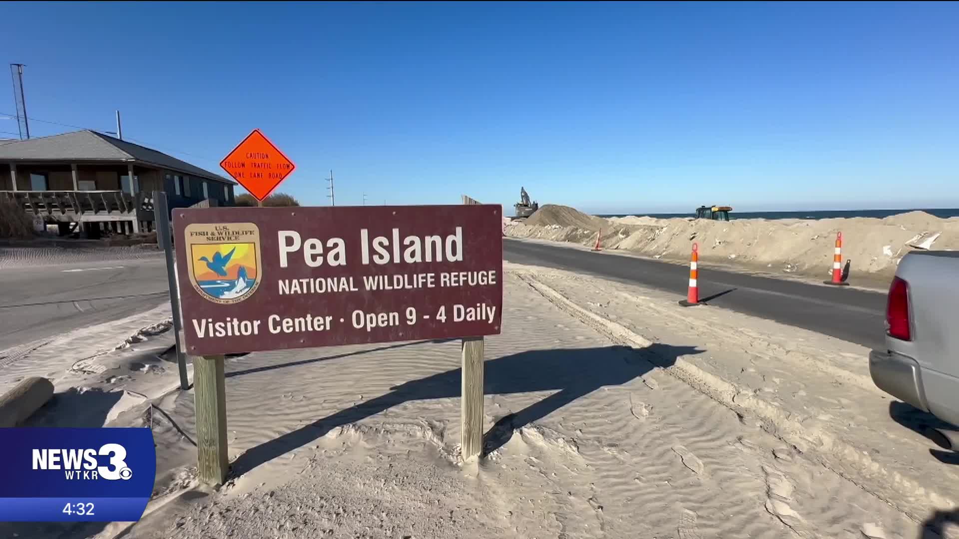


AVON, N.C. — The one-lane detour remains on N.C. 12 near the Pea Island National Wildlife Refuge Visitor Center, and along the oceanfront are massive walls of sandbags. This is the current reality for the portion of the highway that has been destroyed twice and rebuilt in the last seven weeks due to coastal storms.
The impact of both of N.C. 12's extended closures due to damage from two coastal storms this fall is something that isn't going to go away. Many business owners lost the month of October, a crucial part of their shoulder season.
"October was down about $70,000 from the previous year," said Kenna Lidonni, one of the owners at Oceanas Bistro in Avon.
This week, the North Carolina Department of Transportation is hosting public meetings for its "Solving Access for N.C. 12 in Dare County" or "SAND" Plan, which NCDOT has been working on with federal and state partners since January.
The plan is meant to look at short- and long-term solutions to N.C. 12 access on one of the most vulnerable stretches of the highway: between the Marc Basnight Bridge over Oregon Inlet and the Jug Handle Bridge in Rodanthe.
These meetings come at a crucial time for the highway's future. Earlier this month, NCDOT submitted a proposal to relocate around 3,000 feet of N.C. 12 about 180 feet west of where it is now near the Pea Island Visitor Center.
"That's a great idea. I like something different because they've been doing the same thing over and over again, and it's not working clearly," said Lidonni.
But Lidonni, like many Hatteras Island neighbors, is tired of the band-aid solutions to N.C. 12 and hopes a long-term solution will ultimately be a bridge in this area.
"I think a bridge would be the most ideal situation to improve what's going on," said Lidonni.
Hatteras Island neighbors have told News 3 they are happy to be able to attend these meetings and have their voices heard. But there remains concern about when change could actually become a reality for their lifeline.
"I'll believe it when I see it pretty much at this point. Just hoping that whatever they're doing now, will be a band-aid until they can push that road over, and then that will work out to benefit us in the end," said Lidonni.
The next public meeting on the "SAND" Plan will be at the Hatteras Civic Center (56658 N.C. Highway 12) from 5 to 7 p.m. Thursday. There were meetings in Nags Head on Tuesday and Rodanthe on Wednesday.
For now, and probably for most of the winter, Hatteras Island neighbors will continue to keep their fingers crossed every time a storm is off our coast.
"It's frustrating to know or not know, whether you're going to have a road tomorrow if a storm comes through," said Lidonni.
For more information on the plan and how you can submit a public comment, head to NCDOT's website here. The project timeline on this page also shows that a report for the plan is expected to be completed in June 2027.
Click here to see how we use AI at WTKR News 3.
