

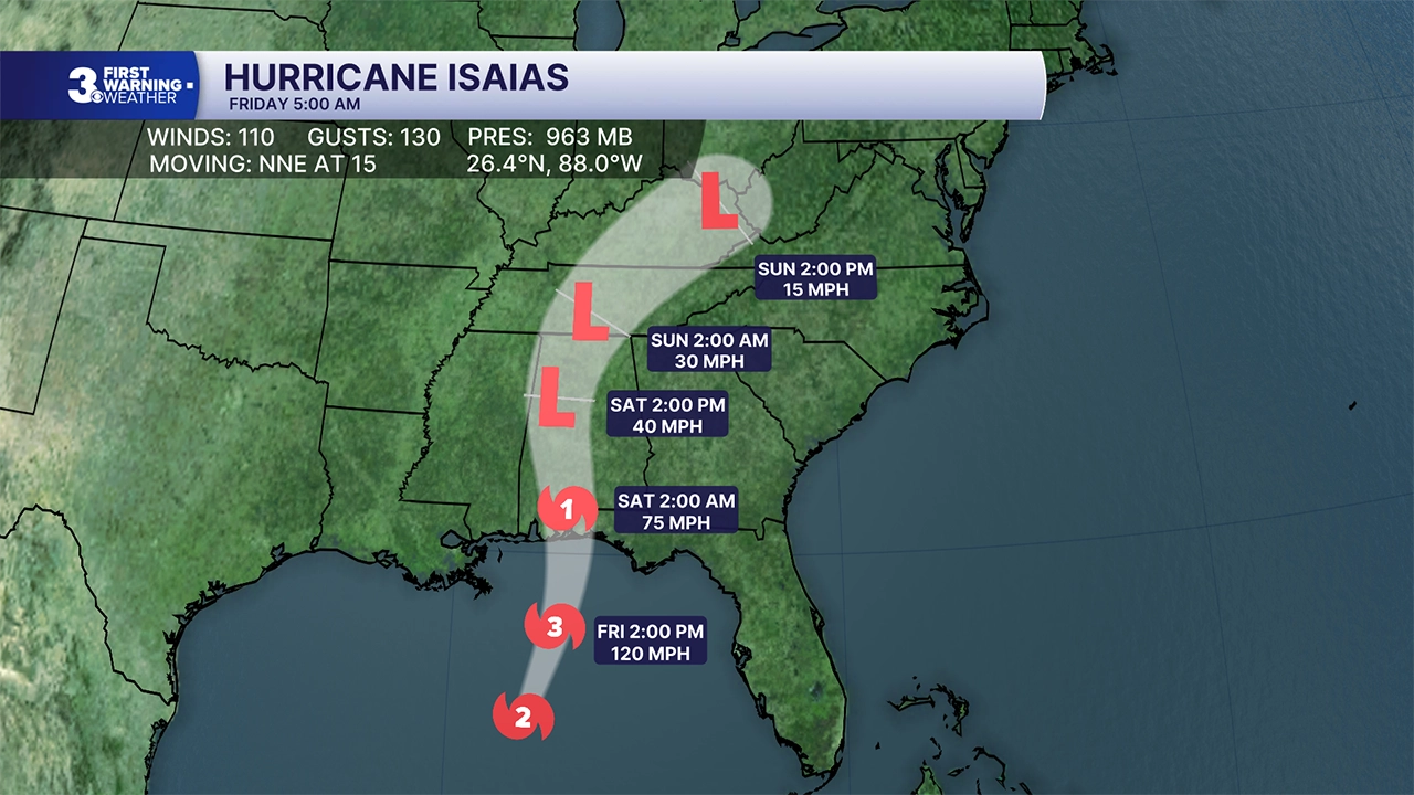


NORFOLK, Va. — Hurricane Isaias became a Category 3 storm early Friday and forecasters say it is expected to be a Category 2 hurricane when it reaches the Gulf Coast.
Isaias will mark the first time in more than two years a hurricane is poised to make a direct strike on the United States.
News 3 is tracking the impact the storm may have on Hampton Roads and Northeastern North Carolina.
Isaias is expected to weaken after making landfall and dissipate into the atmosphere, sending rain toward our region.
Expect mostly cloudy skies on Saturday with highs in the low to mid 70s. Rain will build in Saturday night, but most of the day looks dry. Winds will start to pick up Saturday, east at 10 to 15 mph.
🌀TRACKING ISAIAS: Use Interactive Hurricane Tracker to monitor major hurricane
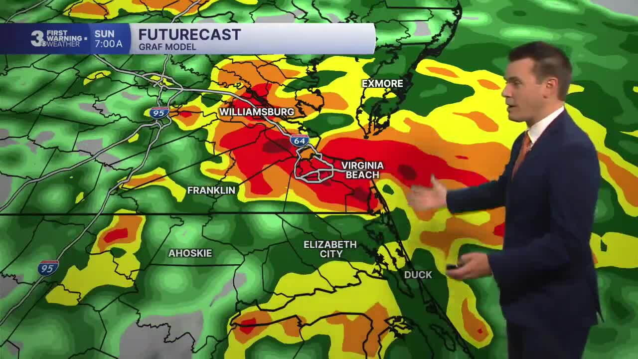
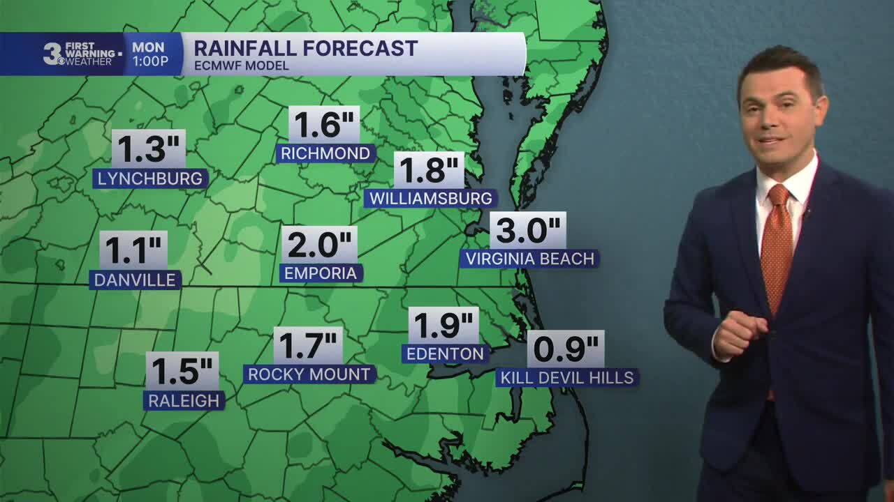
Widespread rain will move in Sunday with a stray storm possible. Most of the region will see 1 to 3 inches of rainfall and localized flooding is possible.
Wind will pick up Sunday, mainly SE at 10 to 20 with gusts to 30 mph. Highs will return to the mid 70s.
This is a developing story, so check back with WTKR.com for updates. Email News 3 if you have info, photos or videos to share.
 Facebook
  TikTok
  YouTube
 Instagram
 Threads
 X
X