Hurricane Debby made landfall off the coast of Florida Monday morning as a category 1 storm around 7 a.m. with 80mph sustained winds and gusts over 100mph.
Much of north Florida and southern Georgia are seeing heavy rain as the storm — moving around 6 mph — makes its way off the coast of Georgia into the ocean.
Around 11 a.m., Debby was downgraded to a tropical storm as it passed over land.
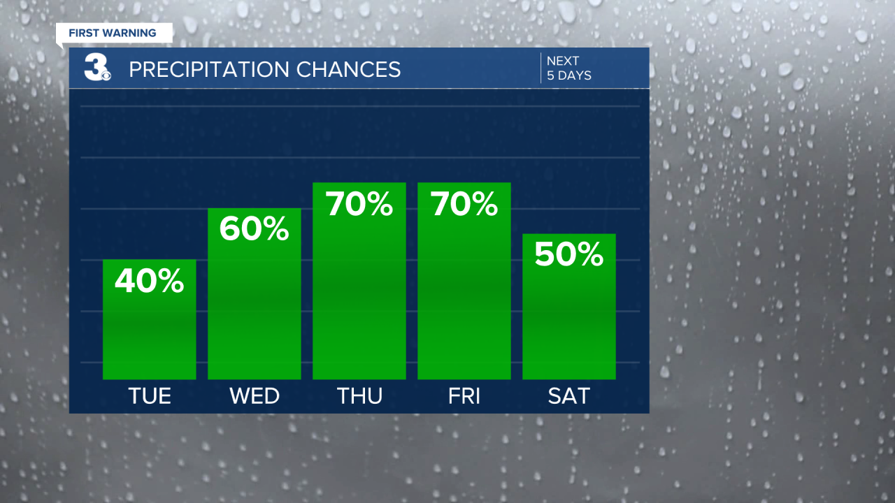
On Monday night, News 3 meteorologist April Loveland said the Hampton Roads and Northeast North Carolina area could start to see some moisture from Debby on Wednesday, with a 60% chance of rain. Then, we'll have our two biggest rain days, with a 70% chance for both Thursday and Friday.

Watch: Debby makes landfall Monday morning
By Thursday afternoon, the storm could move back over land and head toward North Carolina and Virginia, though it's unclear where it will end up, as the forecast cone is very wide Monday morning.
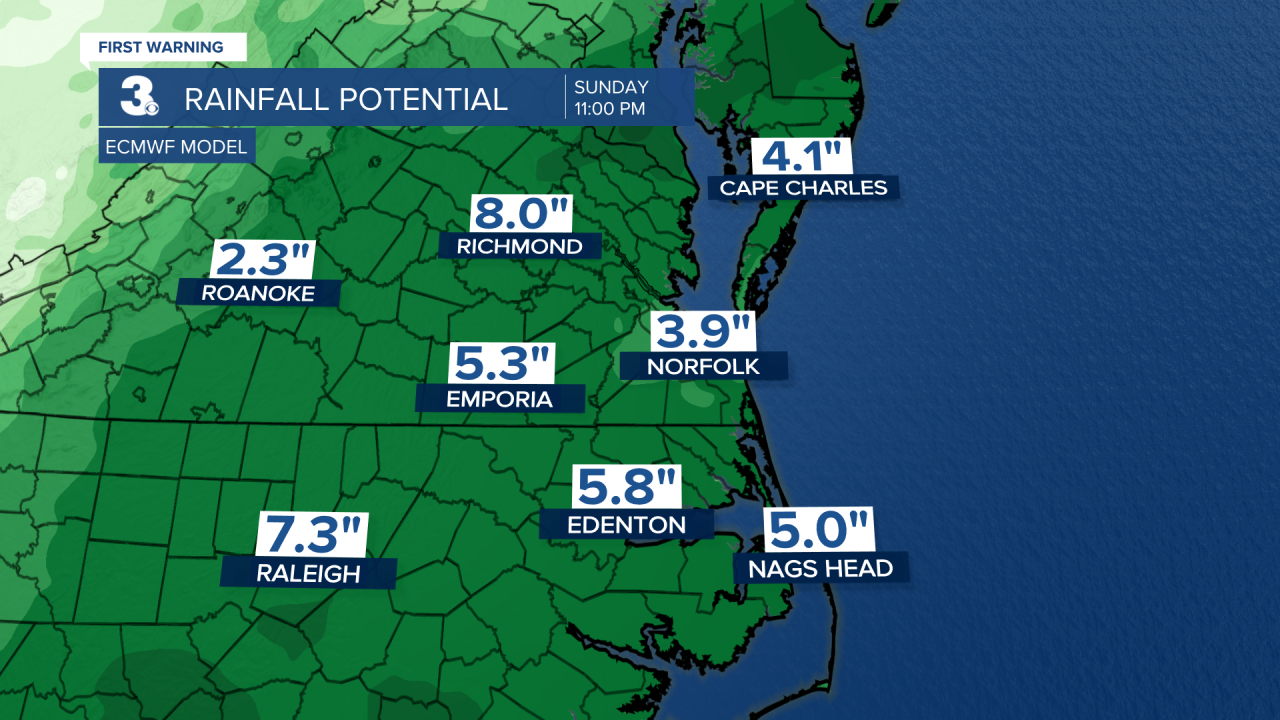
Thursday and Friday are expected to be the wettest days for us, with near 4 inches of rain potentially in southeastern Virginia and up to 5 inches in the Outer Banks, but the severity of that depends on whether the storm picks up strength over the Atlantic.
By Saturday, Debby should move past our area, clearing things up for the weekend.
Watch: What happens if a neighbor's tree falls on your property?
Stay with News 3's First Warning Weather team for the latest as we track Debby's path north.


