


NORFOLK, Va. — The Norfolk Planning Commission has approved the first phase of construction for a future flood wall near the Water Street open space, located next to Harbor Park, to protect the area from flooding.
“It will hold back those waters from coming into the city,” said Kyle Spencer with Resilient Norfolk.
Spencer noted that just last month, the Planning Commission greenlighted Phase One of the Coastal Storm Risk Management Project, which includes the construction of a flood wall throughout the city.
The project is a team effort between the U.S. Army Corps of Engineers and the City of Norfolk.

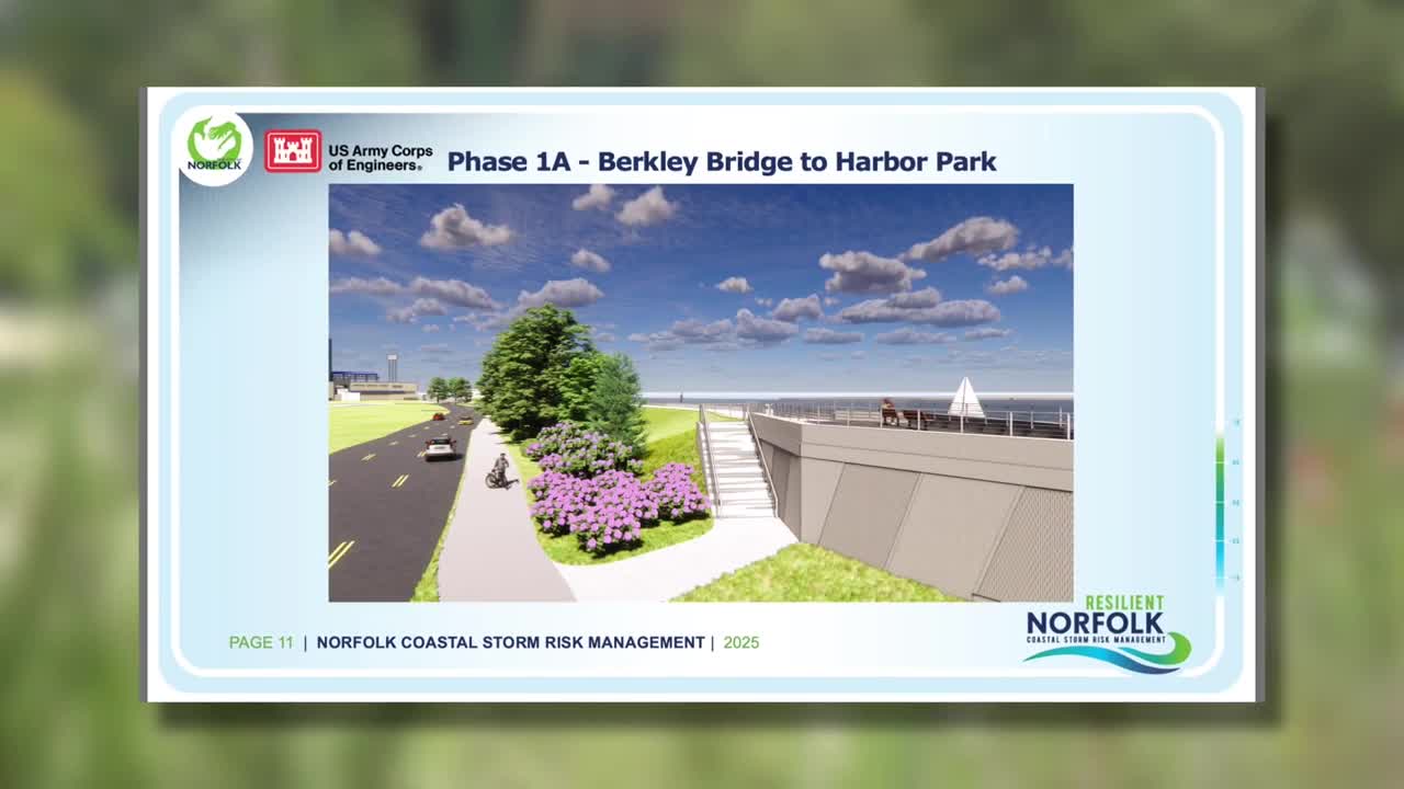
“The first constructible feature we're going to be working on is right here between the Berkley Bridge and the Harbor Park baseball stadium,” Spencer added.
Some relocation of power and water lines is already underway, and demolition work is set to begin this fall in preparation for an elevated flood wall.
The wall will vary in height from 16.5 feet to 6.5 feet, depending on elevation in the city.
Residents will still have a view of the water.

The first phase also includes building two new pump stations and adding amenities such as access to the Elizabeth River Trail on top of the wall.
“Those pump stations will be available to turn on basically anytime there’s a rainstorm, whether there’s a hurricane or not,” Spencer said.
However, construction of the flood wall itself will not start until 2027.

The Resilient Norfolk project comprises five phases, which include not only the construction of flood walls but also initiatives like raising homes and filling basements.
“We’re planning for sea level rise, but storms are getting more intense and severe, so we want this new structure to be able to handle future storm events,” Spencer explained.
The estimated completion date for all phases of the project is set for 2037.
For more information on the project, click here.
