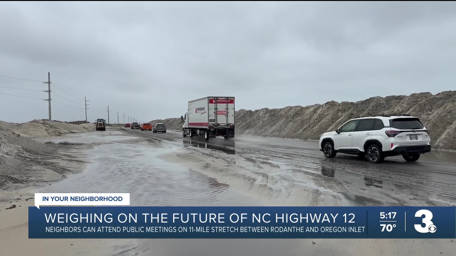


RODANTHE, N.C. — Each time there is any kind of storm that impacts the Outer Banks, there's potential for N.C. 12 down south to be impacted and even closed because of sand and water on the road. NCDOT, federal and local officials are now working on a new plan to address short- and long-term solutions to access the vital highway.
"I'd say the past five, six years, road closures have become more frequent. They've accelerated and become worse, longer closures and worse damage to the highway," said Jason Heilig, owner of Rodanthe Surf Shop.
Heilig has lived on Hatteras Island for 25 years and like many residents and visitors, has been impacted time after time when the Marc Basnight Bridge closes because of sand and water on N.C. 12.
"It's kind of become routine," said Heilig.
NCDOT, the Federal Highway Administration, U.S. Fish and Wildlife Service, the National Park Service and other state and local agencies are now working to develop the Solving Access for N.C. 12 in Dare County or "SAND" plan.
"This plan will focus on improving access along a vulnerable 11-mile stretch of Highway 12, between the Marc Basnight Bridge and Rodanthe. It is vulnerable, as is much of Highway 12, but this area has been found through hydrologic modeling over many decades to be particularly vulnerable to storms and the road is so close to both the sound on one side and the Atlantic Ocean on the other," said Jamie Kritzer, a spokesman for NCDOT.
Officials will be taking into account previous reports like the one the N.C. 12 Task Force put out a few years ago and past successful projects like the Jug Handle Bridge to Rodanthe. But there is also an environmental aspect to this plan — officials want to look at the most environmentally friendly ways to implement these solutions.
"Another part of this plan that's very important, we'll be looking at the environmental impacts that either a short term or a long term solution could have, and determining what are those impacts, how can we minimize any environmental impacts," said Kritzer.
Officials also want to give neighbors and visitors a voice in what this plan will look like, hosting public meetings this week to allow for input.
"We want to be sure we're taking into account the what the community feels, what's important to the people that live out there and that visit the Outer Banks," said Kritzer.
For Heilig, he feels it has to be a multifaceted approach to the issue.
"I think possibly new bridges at those hot spots, a series of jetties and a reinforced dune line. I think that's probably what we need," said Heilig.
But he appreciates the current work NCDOT crews do to keep N.C. 12 open and state and federal organizations giving neighbors a voice about what the future of the lifeline for Hatteras and Ocracoke islands will look like.
"Just knowing that our interests are their interests, at the same time they want a solution, they're being proactive. So it's good to see that level of interest there in saving our island, and all that it brings for visitors and and residents," said Heilig.
The next public meeting will be Thursday from 5:30 to 7:30 p.m. at Jennette's Pier in Nags Head. NCDOT also plans to hold more meetings in late summer and fall. Anyone wanting to provide feedback can visit NCDOT's website here.
tClick here to see how we use AI at WTKR News 3.
