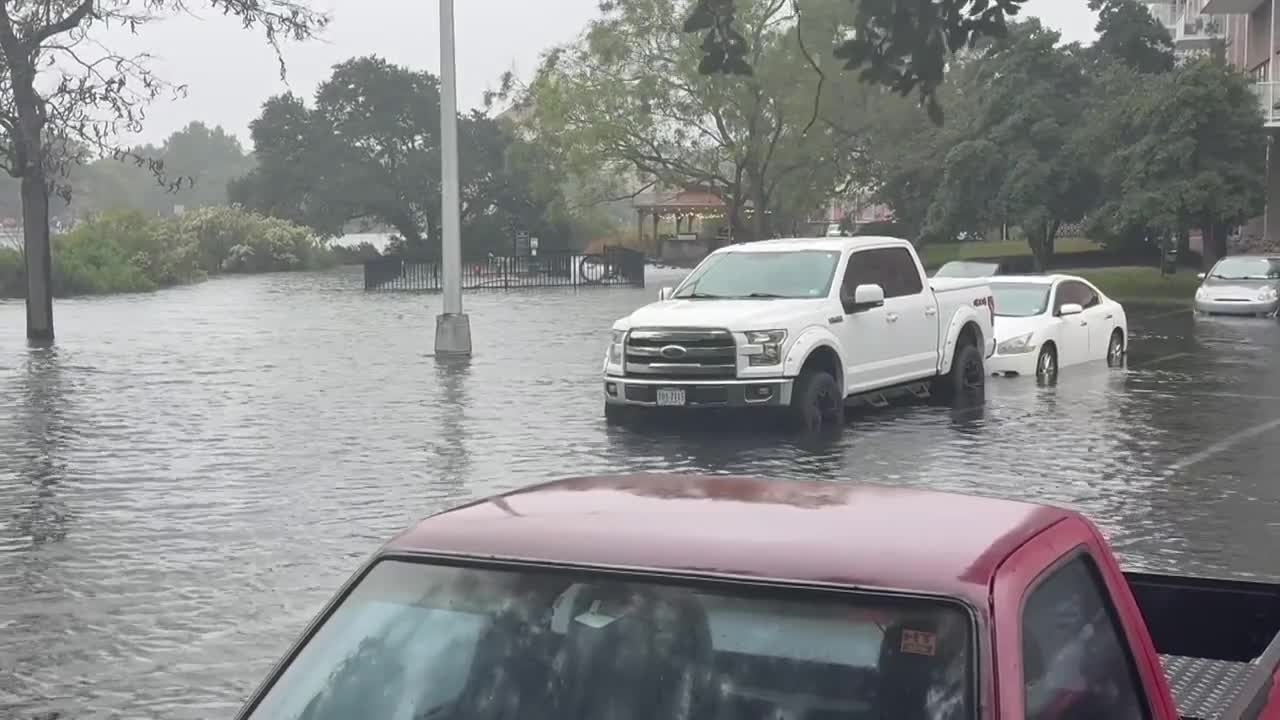


NORFOLK, Va. — A strong coastal storm is lashing Hampton Roads Sunday with gusty winds, steady rain, and widespread flooding in low-lying neighborhoods across Norfolk and Virginia Beach.
The National Weather Service says northeast winds between 25 and 30 mph, with gusts up to 40 mph, are pushing water into the coastline. Some areas along the immediate shore could see gusts topping 50 mph before the system begins to weaken late Sunday night.
A Coastal Flood Warning remains in effect through Monday morning. Officials say Sunday afternoon’s high tide cycle brought major tidal flooding, with moderate flooding expected to continue overnight into early Monday.
In Norfolk, roads flooded across neighborhoods including Ghent, Larchmont-Edgewater, Colonial Place, the Neon District, and parts of downtown. City officials say Public Works crews have kept flood gates closed through Monday, though the downtown gate did not have to be shut.
Transportation crews have been responding to intersections where power outages affected traffic lights, working to ensure they come back online once electricity is restored. Utility operations remain stable, with no major changes reported Sunday.
Residents looking to move vehicles to higher ground can use the York Street Garage, which will be free through Monday, Oct. 13, at 8 p.m. The city also partnered with Old Dominion University, which has opened three garages for public use through the same time:
- 43rd Street and Elkhorn Avenue Garage
- 43rd Street and Bluestone Avenue Garage
- 49th Street and Bluestone Avenue Stadium Garage
In Virginia Beach, standing water was reported along Shore Drive, Sandbridge Road, and the Oceanfront area, with waves and tidal surges pushing water inland.
Temperatures Sunday remained in the upper 60s to low 70s. Rainfall totals between a tenth and a half inch are expected before the storm clears the region late Monday.
Officials continue urging drivers to avoid flooded roads and to stay alert for downed power lines or debris as winds remain strong overnight.
